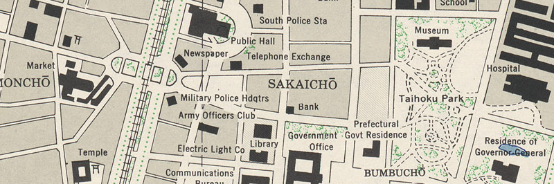
Recently I've found a collection of Formosa (Taiwan) City Plans made by the US Army in 1944 and 1945, based on aerial photographs. To compare how much has changed (or hasn't!) in the years since, I've put together tool to overlay these city plans on their present day satellite imagery (courtesy of Google Maps).
There are altogether 26 maps in the collection, so far I've added the following ones to this site:
Use the tool bar at the top of the page to toggle visibility of the overlay, adjust the opacity to blend the old and new maps, or select another map.
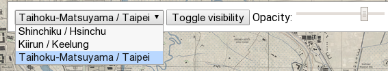
You can also switch between satellite and map views using the selector in the upper left corner, for a different experience.
If you want to know more about how this page was made, and some historical lessons I've found, check out the Taiwan WWII Map Overlays writeup on my blog about the topic!
The maps included are from the Perry-Castañeda Library Map Collection, and Courtesy of the University of Texas Libraries, The University of Texas at Austin. They are under public domain according to the Library Web Material Usage Statement. I'm greatful for their release!
Hacked together by Gergely Imreh. Feedback and comments are welcome!
The source code is available on GitHub.
Creative Commons CC-BY 4.0 license for all text, MIT license for all code.